Otyniia
שם באנגלית:
Otyniia
שם באוקראינית:
Otyniia [Отинiя]
שם בפולנית:
Ołtynia
שם ברוסית:
Otynia [Отыня]
שם בעברית:
Otyniia [ אוטיניה]
שם ביידיש:
Otinya
אזור היסטורי-תרבותי:
Eastern Galicia - Pokuttia
היסטוריה מנהלית:
| Years | State | Province | District |
| Till 1772 | Polish-Lithuanian Commonwealth: Kingdom of Poland | Rus Voivodship (Województwo ruskie) | Tłumacz powiat |
| 1772-1918 | "Hapsburg Empire", since 1804 - Austrian Empire, since 1867 - Austro-Hungarian Monarchy | Kingdom of Galicia and Lodomeria (Königreich Galizien und Lodomerien) | Tłumacz powiat |
| 1914-1915 | Under Russian occupation | General-Government Galitsiia | |
| 1915-1918 | Austro-Hungarian Monarchy | Kingdom of Galicia and Lodomeria (Königreich Galizien und Lodomerien) | Tłumacz powiat |
| 1918 - May 1919 | West-Ukrainian People's Republic | ||
| May 1919 - September 1939 | Republic of Poland | Stanislawów wojewódstwo | Tłumacz powiat |
| September 1939 - June 1941 | USSR: Ukrainian Soviet Socialist Republic | Stanislav oblast' | |
| June 1941 - July 1944 | Under German occupation: General Government (Das Generalgouvernement für die besetzten polnischen Gebiete | Distrikt Galizien | Stanislau Kreishaupt-mannschaft |
| 1944-91 | USSR: Ukrainian Soviet Socialist Republic | Stanislavov (Stanislaviv) oblast'; since 1962 renamed Ivano-Frankovsk (Ivano-Frankivs'k) oblast' | Kolomyia raion |
| Since 1991 | Republic of Ukraine | Ivano-Frankivs'k oblast' | Kolomyia raion |
נתוני אוכלוסייה:
| Year | Total | Jews | Percentage of Jews |
| 1765 | - | 296 | - |
| 1880 | 3,714 | 1,557 | 41.92% |
| 1900 | 4,940 | 2,081 | 42.12% |
| 1921 | 4,445 | 1,728 | 38.87% |
| 1931 | ? | 1,116 | |
| 2005 | 5,327 |
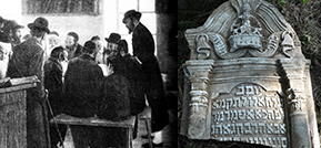
Otyniia is a village on Vorona river, 23 km from Kolomea. There are almost no pre-WWII buildings in the once famous town of Otyniia. All its synagogues are destroyed as well. Only fragments of tombstones remained on the territory of the Jewish cemetery. However, a mill - most probably owned by Jews - still stands near the cemetery.
The photographs made by Dr. Vladimir Levin in August 2009 see at the Gallery section.
פריטים רלוונטיים לקהילה
| כותרת | סוג הפריט | שנה |
|---|---|---|
| "Arkusze ewidencyjne" i wykazy stowarzyszeń żyd... | אינדקס מהארכיון המרכזי לתולדות העם היהודי | 1930 |
| "Arkusze ewidencyjne" i wykazy Zarządów stowarz... | אינדקס מהארכיון המרכזי לתולדות העם היהודי | 1930 |
| "Arkusze ewidencyjne" i wykazy Zarządów towarzy... | אינדקס מהארכיון המרכזי לתולדות העם היהודי | 1930 |
| "Arkusze ewidencyjne" stowarzyszeń żydowskich w... | אינדקס מהארכיון המרכזי לתולדות העם היהודי | 1924 |
| Arkusze ewidencyjne i wykaz członków zarządów S... | אינדקס מהארכיון המרכזי לתולדות העם היהודי | 1931 |
| Arkusze ewidencyjne i wykazy członków zarządów ... | אינדקס מהארכיון המרכזי לתולדות העם היהודי | 1930 |
| Arkusze ewidencyjne i wykazy członków zarządów ... | אינדקס מהארכיון המרכזי לתולדות העם היהודי | 1933 |
| Arkusze ewidencyjne i wykazy członków zarządów ... | אינדקס מהארכיון המרכזי לתולדות העם היהודי | 1934 |
| Arkusze ewidencyjne i wykazy członków zarządów ... | אינדקס מהארכיון המרכזי לתולדות העם היהודי | 1921 |
| Arkusze ewidencyjne i wykazy członków zarządów ... | אינדקס מהארכיון המרכזי לתולדות העם היהודי | 1931 |


