Solotvyn
|
Years |
State |
Province |
District |
|
Till 1772 |
Polish-Lithuanian Commonwealth: Kingdom of Poland |
Rus Voivodship (Województwo ruskie), Halicz Land (Ziemia Halicka) |
Sołotwina starostwo; Kołomyia powiat |
|
1772-1867 |
Hapsburg Empire, since 1804 -Austrian Empire |
Kingdom of Galicia and Lodomeria (Königreich Galizien und Lodomerien) |
Stanislau Gebiet |
|
1867-1914 |
Austro-Hungarian Monarchy |
Kingdom of Galicia and Lodomeria (Königreich Galizien und Lodomerien) |
Bohorodczany powiat (Herbivnyk, 130) |
|
1914-1915 |
Under Russian military occupation |
General-Government Galitsiia |
|
|
1915-1918 |
Austro-Hungarian Monarchy |
Kingdom of Galicia and Lodomeria (Königreich Galizien und Lodomerien) |
Bohorodczany powiat |
|
1918 - May 1919 |
West Ukrainian People's Republic |
|
|
|
May 1919 - Sept. 1939 |
Republic of Poland |
Stanislawów wojewódstwo |
Till 1932 Bohorodczany powiat |
|
Since 1932 Stanislawów powiat |
|||
|
Sept. 1939 - June 1941 |
USSR: Ukrainian Soviet Socialist Republic |
Stanislav oblast' |
Stanislav raion |
|
June 1941 - July 1944 |
Under German occupation:
|
Distrikt Galizien |
Stanislau Kreishaupt-mannschaft |
|
1944-91 |
USSR: Ukrainian Soviet Socialist Republic |
Stanislavov (Stanislaviv) oblast'; since 1962 renamed Ivano-Frankovsk (Ivano-Frankivs'k) oblast' |
Bogorodchany raion |
|
Since 1991 |
Republic of Ukraine |
Ivano-Frankivs'k oblast' |
Bogorodchany raion |
| Year | Total | Jews | Percentage of Jews |
| 1764 | 361 in the town | ||
| 1765 | 82 families | ||
| 1870 | 2,754 | ||
| 1880 | 3,117 | 1,541 | 49.41% |
| 1900 | 3,814 | 1,948 | 51.08% |
| 1921 | 2,136 | 610 | 28.56% |
| 1966 | 5,000 | ||
| 2001 | 3,867 |
According to the statistical data submitted by the local authorities on May 29, 1920, there were 2726 people in Solotvina: 468 Poles, 1572 Russians and 686 Jews. ( CAHJP, Hm2/8888.14)
Read about the "Final Solution" in the Ivano-Frankivs'k (Stanislawow) region (In Hebrew).
Solotvin is an urban settlement on the Bystritsa Solotvinska river (a tributary of the Dniester), at the foot of the Carpathian Mountains, 40 km to south-east from Ivano-Frankivsk, 20 km from Bohorodchany and 19 km to north-west from Nadworna. In the seventeenth century it was named Krasnopol (Słownik, 11: 65-6).
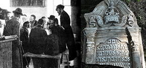
See the views of Solotvin and the complete documentation of the Jewish cemetery there.
Items relevant to the community
| Title | Type of item | Years |
|---|---|---|
| A Rabbi of Solotvin | Люди | |
| A Teacher in Solotvin | Люди | |
| Aisman | Люди | до 1943 |
| Beresh | Люди | |
| Buvenfelts | Люди | до 1943 |
| Daughter of Yeshayahu | Люди | |
| Daughter of Shimon | Люди | до 1675 |
| Daughter of Shimon | Люди | до 1675 |
| Daughter of Yehuda Leib | Люди | |
| Daughter of Yitzhak | Люди | до 1860 |


